University certificate
The world's largest faculty of veterinary medicine”
Why study at TECH?
Do not miss the opportunity to study this Postgraduate diploma in Census and Wildlife Monitoring with us. It's the perfect opportunity to stand out and advance your career”

Unlike other programs, the Postgraduate diploma in Census and Wildlife Monitoring approaches wildlife management from an interdisciplinary point of view.
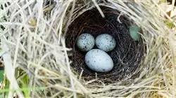
This Postgraduate diploma will address wildlife monitoring in depth and through direct and indirect animal observation by analyzing droppings, nests, pellets and other natural signs thanks to devices such as photo-trapping. Finally, the main methods to census a species, which are fundamental for developing a wildlife monitoring program, will be analyzed in detail.
Wildlife management covers a wide spectrum of lines of research and action, in addition to the study of health surveillance and disease control, which is usually the general line of study in similar programs. However, in the future, veterinary professionals will have to face other lines of work in biodiversity conservation, which are also extensively developed throughout the syllabus.
Nowadays, it is difficult to find a program like this one, which provides students with specialized training in the use of the most common software in daily practice. Today there are many computer tools available that are considered necessary and that facilitate and increase the level of quality of work.
One of the aspects that is usually lost sight of in species management is the territorial analysis of their habitats and their areas of distribution.
Species biology is not only based on theoretical knowledge, but also on spatial and geolocalized data. The only way to understand and visualize how species are distributed is by using Geographic Information Systems to represent and model the data.
This complete program is designed by professors with the highest recognized degree of specialization, thus guaranteeing its quality in all aspects in wildlife, both clinical and scientific. A unique opportunity to specialize in an area where professional positions are in high demand, from the hands of outstanding professionals.
Train with us and learn the concepts associated with wildlife populations and the processes and interactions that take place”
This Postgraduate diploma in Wildlife Census and Monitoring contains the most complete and up-to-date scientific program on the market. The most important features include:
- Case studies presented by experts in Wildlife
- The graphic, schematic, and practical contents with which they are created, provide scientific and practical information on the disciplines that are essential for professional development
- New developments in Wildlife Management
- Practical exercises where the self-assessment process can be carried out to improve learning
- Special emphasis on innovative methodologies in Wildlife Management
- Theoretical lessons, questions to the expert, debate forums on controversial topics, and individual reflection assignments
- Content that is accessible from any fixed or portable device with an Internet connection
This Postgraduate diploma is the best investment you can make when selecting a refresher program in Wildlife Census and Monitoring”
It includes, in its Teaching staff, Professionals belonging to the veterinary field, who pour into this training the experience of their work, in addition to recognized Specialists from Reference Societies and Prestigious Universities.
The multimedia content, developed with the latest educational technology, will provide the professional with situated and contextual learning, i.e., a simulated environment that will provide immersive specialization programmed to learn in real situations.
This program is designed around Problem-Based Learning, whereby the specialist must try to solve the different professional practice situations that arise throughout the program. For this, the professional will have the help of an innovative, interactive video system made by recognized and experienced experts in Wildlife.
This program comes with the best educational material, providing you with a contextual approach that will facilitate your learning”

This 100% online Postgraduate diploma will allow you to combine your studies with your professional work while expanding your knowledge in this field”
Syllabus
The content has been structured and designed by the best Professionals in Wildlife Census and Monitoring, with extensive experience and recognized prestige in the profession, backed by the volume of cases reviewed, studied, and diagnosed, and with extensive knowledge of new technologies applied to veterinary medicine.

We have the most complete and up-to-date academic program in the market. We strive for excellence and for you to achieve it too"
Module 1. Fundamentals of Ecology
1.1. General Ecology I
1.1.1. Reproduction Strategies
1.1.2. Biological Indicators
1.1.2.1. Productivity
1.1.2.2. Sex Ratio
1.1.2.3. Flight Rate
1.1.2.4. Operational Birth Rate
1.1.2.5. Reproductive Success
1.2. General Ecology II
1.2.1. Birth Rate and Mortality
1.2.2. Growth
1.2.3. Density and Assessment
1.3. Population Ecology
1.3.1. Gregariousness and Territorialism
1.3.2. Feeding Area
1.3.3. Activity Patterns
1.3.4. Age Structure
1.3.5. Predation
1.3.6. Animal Nutrition
1.3.7. Extinction: Critical Periods
1.4. Wildlife Census and Monitoring
1.4.1. Life Cycle Critical Periods
1.4.2. International Union for Conservation of Nature (IUCN) Categories
1.4.3. Conservation Indicators
1.4.4. Vulnerability to Extinction
1.5. Surrogate Species I
1.5.1. Keystone Species
1.5.1.1. Description
1.5.1.2. Real Examples
1.5.2. Umbrella Species
1.5.2.1. Description
1.5.2.2. Real Examples
1.6. Surrogate Species II
1.6.1. Flagship Species
1.6.1.1. Description
1.6.1.2. Real Examples
1.6.2. Indicator Species
1.6.2.1. Biodiversity Status
1.6.2.2. Habitat Status
1.6.2.3. Population Status
1.7. Plant Ecology
1.7.1. Plant Successions
1.7.2. Animal-Plant Interaction
1.7.3. Biogeography
1.8. Ecosystems
1.8.1. Factors
1.9. Biological Systems and Communities
1.9.1. Community
1.9.2. Biomass
1.10. Energy Flows
1.10.1. Nutrient Cycles
Module 2. Regulatory Bases in Species Conservation
2.1. Convention on Biological Diversity
2.1.1. Mission and Objectives
2.1.2. Strategic Plan for Biological Diversity
2.2. Convention on International Trade in Endangered Species of Wild Fauna and Flora
2.2.1. Structure and Objectives
2.2.2. Appendices I, II and III
2.3. Ramsar Convention
2.3.1. Structure and Objectives
2.3.2. Designation of Ramsar Sites
2.4. Other International Conventions
2.4.1. United Nations Convention to Combat Desertification
2.4.2. Bonn Convention on the Conservation of Migratory Species
2.4.3. OSPAR Convention
2.5. Berna Convention
2.5.1. Structure and Objectives
2.6. Mission and Objectives
2.7. Mission and Objectives
2.8. South America: National Strategies for Biodiversity
2.8.1. Mission and Objectives
2.8.2. Main Lines of Action
Module 3. Wildlife Census
3.1. Introduction to Observation Methods
3.1.1. Direct Observation
3.1.2. Signs
3.1.2.1. Direct Signs
3.1.2.2. Indirect Signs
3.1.3. Electric Fishing
3.2. Indirect Signs: Natural Signs I
3.2.1. Natural Signs
3.2.1.1. Tracks
3.2.1.2. Paths and Steps
3.2.1.3. Droppings and Pellets
3.3. Indirect Signs: Natural Signs II
3.3.1.1. Sleeping Sites, Beds and Burrows
3.3.1.2. Territorial Markings
3.3.1.3. Moults, Hairs, Feathers and Other Remains
3.4. Indirect Signs: Techniques
3.4.1. Devices
3.4.1.1. Hair Traps
3.4.1.2. Sand Traps
3.4.1.3. Photo-Trapping
3.5. Census Design
3.5.1. Previous Concepts
3.5.1.1. Sizes and Density
3.5.1.2. Abundance Index
3.5.1.3. Accuracy and Precision
3.5.2. Populations
3.5.2.1. Aggregate Distribution
3.5.2.2. Uniform Distribution
3.5.2.1. Manipulable
3.5.3. Detectability and Catchability
3.5.4. GPS Data Acquisition
3.6. Direct Census: Static
3.6.1. Searches
3.6.2. Observation Points
3.6.3. Estimates from Hunting
3.7. Direct Census: Dynamic Census
3.7.1. Plot Census without Search
3.7.2. Fixed Band Transects
3.7.3. Line Transects
3.7.3.1. Capture-Recapture
3.7.3.1.1. Modifying of the Number of Individuals
3.7.3.1.2. Not Modifying the Number of Individuals
3.8. Wildlife Monitoring
3.8.1. Introduction to Ethology
3.8.2. Research Design
3.8.2.1. Behavior Description
3.8.2.2. Category Selection
3.8.2.3. Behavior Measures
3.8.2.4. Types of Sampling
3.8.2.5. Types of Recording
3.8.2.6. Inventories
3.9. Tracks
3.9.1. Influencing Factors
3.9.2. Ecological Information
3.9.3. Morphology
3.9.4. Finding and Preserving Tracks
3.9.5. Keys
3.10. Wildlife Monitoring Programs
3.10.1. Main Experiences in South America
Module 4. Spatial Management of Species using Geographic Information Systems in QGIS
4.1. Introduction to Geographic Information Systems (GIS)
4.1.1. Introduction to Geographic Information Systems
4.1.2. Mapping File Formats for Species Analysis
4.1.3. Main Geoprocessing Analyses for Species Management
4.2. Reference Systems in Map Files
4.2.1. The Importance of Reference Systems in the Visualization and Accuracy of Field Data Linked to Species Distribution
4.2.2. Examples of Correct and Incorrect Data Management in Species Domains
4.3. QGIS Interface
4.3.1. Introduction to QGIS
4.3.2. Interface and Sections to be Analyzed and Data Display
4.4. Data Visualization and Display on QGIS
4.4.1. Visualizing Mapping Data on QGIS
4.4.2. Attribute Tables for Querying and Documenting Information
4.4.3. Symbolism for Sample Representation
4.5. QGIS Plug-ins for Species Mapping and Analysis
4.5.1. QGIS Plug-ins
4.5.2. GBIF Plug-in
4.5.3. Natusfera Plug-in
4.5.4. Species Explorer Plug-in
4.5.5. Citizen Science Platforms and Other Analysis Plug-ins
4.6. Cartographic Management of Sample Plots and Field Monitoring
4.6.1. Geometric Planning of Sampling Plots and Grids
4.6.2. Representation of Distribution Data, Sampling Data and Transects in the Field
4.7. Species Richness and Effort Maps
4.7.1. Analysis of Species Richness Data
4.7.2. Representation of Richness Maps
4.7.3. Analysis of Effort Data
4.7.4. Representation of Effort Maps
4.8. Practical Example: Multi-Criteria Analysis for Species Suitability Maps
4.8.1. Introduction to the Use of Land Suitability Maps
4.8.2. Analysis of Environmental Variables Linked to the Species
4.8.3. Analysis of Suitability Values for the Variables
4.8.4. Elaboration of Land Suitability Maps for Species
4.9. Creation of Ecological Corridors for Species Distribution
4.9.1. Introduction to Spatial Connectivity Strategies to Create Ecological Corridors
4.9.2. Resistance and Friction Maps vs. Suitability Maps
4.9.3. Identification of Connectivity Points
4.9.4. Development of Ecological Corridors for Species Distribution
4.10. Considerations for Field Data Collection
4.10.1. Available Technologies
4.10.2. Device Configuration prior to Data Collection
4.10.3. Technical Considerations in Data Documentation
4.10.4. Considerations according to the Scale of Work

This program will allow you to advance in your career comfortably"
Postgraduate Diploma in Wildlife Censuses and Monitoring
The great amount of efforts, both governmental and private, united for the protection and conservation of wildlife, have generated a growing interest in hiring professionals in veterinary medicine specialized in the field. Understanding the constant academic updating as a fundamental and indispensable element for an adequate work performance in the sector, in TECH Global University we have designed our program of Postgraduate Diploma in Census and Monitoring of Fauna. This postgraduate course will pay special attention to the particularities, concepts, elements and previous studies to be taken into account in the design, planning and structuring of a wildlife census. In addition, the following topics will be modernized in depth: The identification of the regulatory bases, of legislative and normative character, regarding species conservation; and the role of fixed band transects and line transects in the development of dynamic censuses.
Study a Postgraduate Diploma online
The large number of factors that intervene in multiple ways in the optimal advancement of a wildlife census highlight this specialty of the veterinary sector as a field that requires the presence of professionals with a high capacity for adaptation and resolution. In our program, wildlife monitoring will be approached from the knowledge of its multiple fields of development, contemplating the latest innovations in the sector. In this way, we will focus on the updating of the following concepts: The importance of the identification of tracks, territorial marks and other indirect signs in wildlife censuses; and the different processes used in the cartographic management of sampling and monitoring plots in the field, from the geographical planning of the same, to the representation of distribution data.


