University certificate
The world's largest faculty of engineering”
Why study at TECH?
Drone flying is on the rise, and acquiring the skills to become a pilot in this sector is a highly useful competency to gain in an ever-growing industry"
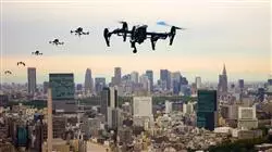
The drone market is helping government agencies and academies to reinvent the aeronautical world. The advancement of drones implies a growing need for designers and pilots to acquire specialist knowledge and skills in the field. It is not the same to fly an amateur drone as it is to fly a high-value drone for specialized operations. That is why this intensive specialization is so necessary, as it will facilitate the training of professionals who are specialists in drones.
With this in mind, the professionals at TECH have designed this very complete Advanced master’s degree that aims to train students in the Design and Piloting of Drones so that they acquire complete and transversal skills to work optimally in this sector. Thus, this educational program will cover the contents and techniques of unmanned aircraft flight in different professional scenarios across the world, as well as the technical aspects involved in their design and assembly.
Likewise, during the specialization, professionals will learn both operational and safety aspects. In this regard, the student will learn more about the institution that holds aeronautical authority: The Aviation Safety Agency. In this regard, we will delve into the ways to facilitate compliance with the regulations in force, through acceptable means of compliance. In the same legal section, the specific regulations of different Latin American countries such as Chile, Colombia and Mexico will also be addressed.
In the same way, throughout the specialist course, there will be a study and analysis of meteorology, which provides specific knowledge for safe flights: An essential part of aeronautics. In this sense, the student will have the opportunity to learn how AEMET works. This is the State Meteorological Agency that provides pilots with aeronautical information in the form of forecasts that serve to ensure the viability of the flight. In this regard, two specific documents will be analyzed: The Guide to Meteorological Services for Air Navigation and the Aeronautical Meteorological Information Guide.
If you are looking for a quality specialization that will help you to specialize in one of fields with most professional opportunities, then this is your best option”
This Advanced master’s degree in Drone Design and Piloting contains the most complete and up-to-date educational program on the market. The most important features include:
- The latest technology in e-learning software
- A highly visual teaching system supported by graphic and schematic contents that are easy to assimilate and understand
- The development of practical case studies presented by practising experts
- State-of-the-art interactive video systems
- Teaching supported by telepractice
- Continuous updating and retraining systems
- Self-regulated learning: fully compatibility with other occupations
- Practical exercises for self-assessment and learning verification
- Support groups and educational synergies: Questions to the expert, discussion forums and knowledge
- Communication with the teacher and individual reflection work
- Content that is accessible from any fixed or portable device with an Internet connection
- The supporting documentation data banks are permanently available, even after the program
Apply the latest advances in Drone Flights in your daily practice and give your resume a boost in value"
Our teaching staff is made up of working professionals. In this way, we ensure that we provide you with the up-to-date training we are aiming for. A multidisciplinary staff of trained and experienced professionals from a variety of environments, who will develop theoretical knowledge in an efficient manner, but above all, will put at the service of specialization the practical knowledge derived from their own experience.
The efficiency of the methodological design of this Advanced master’s degree enhances the student's understanding of the content. Developed by a multidisciplinary team of e-learning experts, it integrates the latest advances in educational technology. In this way, the student will be able to study with a range of comfortable and versatile multimedia tools that will give them the operability they need in their training.
The design of this program is based on Problem-Based Learning, an approach that conceives learning as a highly practical process. To achieve this remotely, we will use telepractice. With the help of an innovative interactive video system, and Learning from an Expert, you will be able to acquire the knowledge as if you were actually dealing with the scenario you are learning about. A concept that will allow students to integrate and memorize what they have learnt in a more realistic and permanent way.
A training program created for professionals who aspire to excellence that will allow you to acquire new skills and strategies in a smooth and effective way"

A deep and comprehensive look at the most up-to-date strategies and approaches in Drone Design and Piloting"
Syllabus
The contents of this Advanced master’s degree have been developed by the different experts on this course, with the clear purpose: of ensuring that our students acquire each and every one of the necessary skills to become true experts in this field. The content of this course will enable you to learn all aspects of the different disciplines involved in this field. A complete and well-structured program that will take you to the highest standards of quality and success.
Through a very well-organized program, you will be able to access the most advanced knowledge in Drone Design and Piloting"
Module 1. Particularities of Drones
1.1. Applicable Legislation
1.1.1. In the World
1.1.1.1. The ICAO
1.1.1.2. JARUS
1.2. USA: The Paradigm
1.2.1. Requirements
1.2.2. Pilot Profiles
1.2.3. 2020 Innovations: LAANC
1.3. Europe
1.3.1. EASA: General Aspects
1.3.2. EASA: Particularities
1.4. Drones as Model Aircraft
1.4.1. Flight Categories
1.4.1.1. Recreational Flight
1.4.1.2. Free Flight F1
1.4.1.3. Circular Flight F2
1.4.1.4. Radio-Controlled Flight F3
1.4.1.5. Scale Models F4
1.4.1.6. Models with an Electric Motor F5
1.4.1.7. Spatial Models S
1.5. Drones as Sport
1.5.1. Competitions
1.5.2.1. International
1.6. Operational Applications of Drones in Engineering I
1.6.1. Applications in Cartography - Photogrammetry
1.6.2. Applications in Civil Engineering
1.7. Operational Applications of Drones in Engineering II
1.7.1. Applications in Thermography
1.7.2. Environmental Applications
1.8. Operational Applications of Drones in Engineering III
1.8.1. Applications in Mining
1.8.2. Applications in Inspections
1.9. Operational Applications of Drones in Engineering IV
1.9.1. Applications in Artistic Photography and Shows
1.9.2. Applications in Air, Radio and TV Advertising
1.9.3. Applications in Security and Emergencies
1.9.4. Applications in Agriculture
Module 2. Occupational Risk Prevention With Drones
2.1. Specific Regulations
2.1.1. Specific Regulations
2.1.2. Risk Assessment
2.2. Equipment and Machinery
2.2.1. Equipment
2.2.2. Machinery
2.3. Dangerous Goods Regulations (DGR)
2.3.1. Dangerous Goods
2.3.2. Classification and Action Taken in Accidents and Incidents with Dangerous Goods
2.4. Hygiene and Ergonomics
2.4.1. Hygiene
2.4.2. Ergonomics
2.5. PPE
2.5.1. PPE
2.5.2. Use
2.6. Emergency Situations
2.6.1. Self-Protection Plans
2.6.2. Actions to Take in Emergency Situations
2.7. Procedures in Cases of Occupational Accidents
2.7.1. Procedures in Cases of Occupational Accidents
2.7.2. Accident and Incident Investigations
2.8. Health Surveillance
2.8.1. Company Obligations
2.8.2. Emergency Planning
2.9. Outdoor Work
2.9.1. Hazards for People Working Outdoors
2.9.2. Preventive Measures for Outdoor Work
2.10. Work With Drones
2.10.1. Hazards for People Working With Drones
2.10.2. Preventive Measures for Working With Drones
Module 3. R&D&I: Aircraft Performance
3.1. Fixed-Wing Aircraft I
3.1.1. Energies Acting on the Aircraft
3.1.2. Forces Acting on the Aircraft
3.2. Fixed-Wing Aircraft II
3.2.1. Glide Ratio
3.2.2. Stability. Axis of an Aircraft
3.2.3. Center of Gravity and Center of Pressure
3.2.4. Loss and Auger
3.3. Rotary Wing Aircraft I
3.3.1. Energies Acting on the Aircraft
3.3.2. Forces Acting on the Aircraft
3.4. Rotary Wing Aircraft II
3.4.1. The Rotary System
3.4.2. Induced Oscillation
3.4.2.1. PIO
3.4.2.2. MIO
3.4.2.3. AIO
3.5. Methodology for RPAS Flights
3.5.1. Preflight: Safety Check List
3.5.2. Take Off and Ascension
3.5.3. Cruise Control
3.5.4. Descent and Landing
3.5.5. After Landing
3.6. Flight Profiles and Operation Characteristics
3.6.1. Object
3.6.2. Operation Characteristics
3.6.3. What’s Included in the Flight Preparation?
3.6.4. Normal Operation
3.6.5. Situations in Abnormal Conditions and Emergencies
3.6.6. Analysis and Closing of Flight Operations
3.6.7. Methodology for Creating Flight Profiles
3.7. Flight Planning: Risk Determination
3.7.1. Risk Factors
3.7.2. Put into Practice
3.8. Methodology for the Development of the EAS of Declarative Operations I
3.8.1. General Methodology
3.9. Methodology for the Development of the EAS of Declarative Operations II
3.9.1. SORA Methodology
Module 4. Design and Engineering I: Specific Knowledge of Drones
4.1. Aircraft Classification for the Pilot and the Engineer
4.1.1. Generic
4.2. Flight Principles for the Pilot and the Engineer
4.2.1. Exogenous Principles
4.2.1.1. Bernoulli's Theorem, Venturi Effect, Action and Reaction Principle
4.2.2. Endogenous Principles
4.2.2.1. The Plane, Airfoil, Angle of Attack, Boundary Layer, Performance
4.3. RPAS Requirements for the Pilot and the Engineer
4.3.1. Identification, Registration and Airworthiness
4.3.2. Records: Registration, Type and Special Certificates
4.3.3. Requirements
4.4. Design and Engineering: Characterization of the Aircraft
4.4.1. Aircraft Cell
4.4.2. On-Board Equipment
4.4.3. AGUILA-6 Characteristics
4.5. Basic Maintenance Theory for the Pilot and the Engineer
4.5.1. Object, Scope and Applicable Regulations
4.5.2. Contents
4.6. Design of Components of the Aircraft and Tools for Engineering
4.6.1. Components
4.6.2. Tools
4.7. Basic Maintenance Practice for the Pilot and the Engineer
4.7.1. Limitations
4.8. Types of Revision in the Basic Maintenance for the Pilot and the Engineer
4.8.1. Initial
4.8.2. Periodical
4.9. Basic Aircraft and Ground Station Maintenance for the Pilot and Engineer
4.9.1. Before the Flight
4.9.2. After the Flight
4.10. Use of Lithium Polymer Batteries
4.10.1. Charge, Use and Storage
4.10.2. Basic Calculation of Autonomy
Module 5. Design and Engineering II: Advanced Maintenance of Drones
5.1. Introduction and Objectives of Maintenance for the Engineer
5.1.1. Introduction
5.1.2. Objectives
5.1.2.1. Avoid Breakdown Shutdowns
5.1.2.2. Avoid Anomalies Caused By Insufficent Maintenance
5.1.2.3. Conservation
5.1.2.4. Scope and Useful Life of Productive Assets
5.1.2.5. Innovation, Technification and Automation of the Process
5.1.2.6. Reduction of Business Costs
5.1.2.7. Integration of Departments: Maintenance, Operations and R&D
5.2. Factors and Typologies for the Engineer
5.2.1. Factors
5.2.1.1. Company Resources
5.2.1.2. Organization, Structure and Responsibilities
5.2.1.3. Training
5.2.1.4. Implantation and Management
5.2.1.5. Coordination
5.2.2. Typology
5.2.2.1. Classification
5.2.2.2. Preventative Maintenance
5.2.2.3. Corrective Maintenance
5.2.2.4. Predictive Maintenance
5.3. Preventative Maintenance Plan for Engineers
5.3.1. Advantages
5.3.2. Phases
5.3.3. Programming
5.3.4. Safety, Quality and Environmental Promise
5.4. Planned Maintenance Program. AGUILA-6 for the Pilot and the Engineer
5.5. Maintenance Control Systems
5.5.1. Maintenance Theory
5.5.2. Maintenance Organization
5.5.3. Controlling the Maintenance Process
5.5.4. Elements Related to the Concept of Control
5.5.5. Good Control Requirements
5.5.6. Applied Control Techniques
5.5.7. Maintenance Management Process of a Company
5.5.8. Administration and Control
5.5.9. Maintenance Control in an Organization
5.6. Aircraft and Equipment Ground Operations
5.6.1. Installation and Calibration Plan
5.6.2. Put to Work: Before, During and After the Flight
5.7. Technological Installations of the Aircraft for the Engineer
5.7.1. Mechanics
5.7.2. Hydraulic
5.7.3. Pneumatic
5.8. Electrical Installation for the Engineer
5.8.1. Definition
5.8.2. Technology: Taxonomy of the Drone
5.8.3. Electronics
5.9. Document Management Systems for the Pilot and the Engineer
5.9.1. Definition
5.9.2. General and Specific Documents
5.9.3. Obligatory Documents
5.10. Technical Documentation for Operation in Different Operational Scenarios
Module 6. Thermography with Drones I
6.1. Thermography and Drones
6.1.1. Definitions
6.1.2. Background
6.2. Physical Foundations of Infra Red Thermography
6.2.1. Transmission of Heat
6.2.2. Electromagnetic Radiation
6.3. Application in RPAS
6.3.1. Typology
6.3.2. Components of RPAS Systems
6.4. Integration in Unmanned Aerial Platforms
6.4.1. Choice of Camera
6.4.2. Image
6.5. Thermal Imaging Cameras
6.5.1. Functioning and Characteristics
6.5.2. Main Cameras on the Market
6.6. Application of Thermographic Images in Engineering
6.6.1. In Construction and Industry
6.6.2. In Agriculture and Livestock Farming
6.6.3. In Emergencies
6.7. Taking Thermographic Images
6.7.1. Taking Images
6.7.2. Calibration
6.8. Processing of Thermographic Data
6.8.1. Preliminary Process
6.8.2. Image Analysis
6.9. Visualization, Editing and Analysis Software
6.9.1. Flir Tools
6.9.2. Program Management
6.10. Most Frequent Errors
6.10.1. Taking Images
6.10.2. Image Interpretation
Module 7. Thermography with Drones II
7.1. Applied Theory
7.1.1. The Blackbody and Hot Spot
7.1.2. Radiation Theories
7.2. Infra Red Thermography II
7.2.1. Active Thermography and Passive Thermography
7.2.2. The Thermogram
7.2.3. Conditions of Application
7.3. Causes and Effects of the Measurement
7.3.1. Laws and Physical Principles
7.3.2. The Measured Object. Factors Affecting It
7.4. Temperature and Distortions
7.4.1. Measuring Systems and Units
7.4.2. Distortions
7.5. Software and Hardware
7.5.1. Software
7.5.2. Hardware
7.6. Missions
7.6.1. Static Mission: Wind Farms and Solar Plants
7.6.2. Dynamic Mission: Vigilance and Security
7.7. Social Actions
7.7.1. Fire Fighting
7.7.2. Rescue and Emergency
7.8. Analysis and Diagnosis
7.8.1. Interpretive Analysis and Diagnosis
7.8.2. Functional Analysis and Diagnosis
7.9. Reports
7.9.1. Thermographic Report
7.9.2. Field Analysis
7.10. Report to be Submitted
7.10.1. Equipment and Criteria
7.10.2. Report Example
Module 8. Geographic Information Technology for Drones
8.1. Particularities of Geographical Information Technology
8.1.1. Geographical Information Technology
8.1.2. Land Planning and Management
8.2. Hardware and Software. Implementation of Spatial Data
8.2.1. Physical Hardware Resources Applied to Work with RPAS
8.2.2. Logical Resources Software for Data Processing
8.3. Quality of Spatial Data. Data Sources and Resources
8.3.1. Notions on Spatial Data
8.3.2. Spatial Data Infrastructure (SDI)
8.4. Develop Coordinate Systems and Data Formats
8.4.1. Geographical Coordinates (Latitude, Longitude vs. UTM)
8.4.2. Vector and Raster Data
8.5. Geographical Information Systems (GIS) and RPAS
8.5.1. GIS
8.5.2. Implementation of RPAS Data in GIS
8.6. Application of GPS and GIS in Spatial Data Production
8.6.1. Spatial Data Base Management
8.6.2. Interoperability Between Data Management Devices
8.7. Practical Applications in the Development and Management of Real Estate
8.7.1. The Real Estate Cadastre
8.8. Practical Applications in the Development and Management of Land Use
8.8.1. Landscape and Land Uses
8.8.2. ICT and the Analysis of Land Use
8.8.3. CORINE Land Cover (Coordination of Information on the Environment)
8.9. Protected Natural Spaces
8.9.1. Conditions for the Use of RPA's in Protected Natural Spaces
8.10. Project Planning with RPAS and GIS for Land Planning and Management
8.10.1. Techniques and Methods of Project Planning
Module 9. Aerial Surveys and Photogrammetry with Drones
9.1. Principle Fundamentals Photogrammetry
9.1.1. Objectives of Photogrammetry and Aerial Surveys
9.1.2. Photogrammetry with Drones
9.1.3. Application of Photogrammetry with Drones
9.1.4. Results of Aerial Survery: Ortho-Mapping, Digital Surface Models, 3D Models, Point Clouds
9.2. Photography Concepts Applicable to Photogrammetry with Drones
9.2.1. General Photography, Focus, Lights, Precision
9.2.2. Digital Model Training
9.2.3. Three Fundamental Axis for Quality Surveys
9.2.3.1. Focal Length
9.2.3.2. Flight Altitude
9.2.3.3. Sensor Size
9.2.3.4. Mechanical Shutter vs. Electrical Shutter
9.3. Photogrammetry with Drones
9.3.1. Fundamental Concepts of Quality, Precision and Geographical Precision
9.3.2. Development of Aerial Surveys
9.3.2.1. Image Acquisition
9.3.2.1.1. Height
9.3.2.1.2. Image Overlapping (Superimposition)
9.3.2.1.3. Flight Speed
9.3.2.1.4. Direction and Orientation of the Aircraft
9.4. Use of Ground Control Points
9.4.1. Objective for the Placement of Ground Control Points
9.4.2. UTM Zones
9.4.3. Measuring of Ground Control Points
9.4.4. Organization and Distribution of Control Points
9.4.5. Types of Visual Objectives of the Control Points and Recommendations
9.5. Drones and Recommended Equipment for Photogrammetry Aerial Surveys
9.5.1. Configuration of the Flight Parameters
9.5.2. Camera Configurations
9.6. Practical Survey
9.6.1. Weather Conditions for a Survey
9.6.2. Terrain Analysis
9.6.3. Extension and Area to be Covered
9.6.4. Light and Shade Management
9.7. DroneDeploy Software to Capture Autonomous Flight Images
9.7.1. Parameters to Establish
9.7.2. Creation of Autonomous Missions
9.7.3. Data Mining and Warehousing
9.8. Drone Flight and Data Collection
9.8.1. Safety and Pre-Flight Checks
9.8.2. Importing Missions
9.8.3. Enrichment of Models
9.9. Data Processing in DroneDeploy
9.9.1. Data Revision
9.9.2. Image Importing
9.10. Deliverables
9.10.1. Orthomaps
9.10.2. Point Cloud
9.10.3. Digital Models and Level Curves
9.10.4. Volumetric Measurement
Module 10. Operations Manual
10.1. Definition, Title Page and Table of Contents
10.2. Revisions Records
10.2.1. List of Effective Pages
10.3. Introduction
10.3.1. Responsible Declaration
10.3.2. Object and Scope
10.3.3. Definitions
10.3.4. Applicable Regulations
10.4. Administration and Control. Organization and Responsibilities
10.4.1. Administration and Control of the Operations Manual
10.4.1.1. Amendments and Revisions
10.4.1.2. Document Control
10.4.1.3. Head of the Distribution and Control of Documents
10.4.2. Organization and Responsibilities
10.4.2.1. Authorized Pilots
10.4.2.2. Organizational Structure
10.4.2.3. Responsibilities and Functions of the Management Personnel
10.4.2.4. Functions and Responsibilities of the Members of the Organization
10.5. Requirements and Precautions
10.5.1. Qualification and Training Requirements
10.5.1.1. Requirements for the Pilot
10.5.1.2. Training and Previous Experience
10.5.1.3. Training Program
10.5.1.4. Training Records and Recurrent Training
10.5.1.5. Aircraft Maintenance
10.5.2. Precautions Relative to Health of the Staff
10.5.2.1. Precautions Relative to the Environmental Conditions of the Operations Zone
10.5.2.2. Alcohol Intake
10.5.2.3. Narcotics
10.5.2.4. Immunization
10.5.2.5. Blood Donation
10.5.2.6. Food Precautions
10.5.2.7. Sleep and Rest
10.5.2.8. Surgical Operations
10.6. Limitations and Type of Operation
10.6.1. Limitations of Flight Time
10.6.1.1. Maximum Activity
10.6.1.2. Excesses and Reduction of Rest Periods
10.6.1.3. Flight Records for Each Pilot
10.6.2. Types of Operation to Carry Out
10.6.2.1. List of Activities
10.6.2.2. Description of Operations and Aerial Work
10.6.2.3. Necessary Skills and/or Authorizations
10.6.2.4. Personnel, Fleet and Equipment Required
10.7. Control and Supervision of the Operations
10.7.1. Accident Prevention Program and Flight Safety
10.7.2. Emergency Measures
10.7.3. Validity of Authorizations and Permissions
10.7.4. Compliance with Pilot Requirements
10.7.5. Compliance with Mitigation Measures
10.7.6. The Aircraft
10.7.7. Operational Control
10.7.8. Authority Faculties
10.8. Procedures
10.8.1. Procedures
10.8.2. Monitoring of Air Operations
10.8.3. Completion of the Air Operation
10.9. Operational Aspects. Accidents and Incidents
10.9.1. Operational Aspects Related to the Type of Aircraft
10.9.2. Treatment, Notification and Report of Accidents, Incidents and Events
10.10. Security and Compliance With the Requirements
10.10.1. Security
10.10.1.1. Measures Adopted to Avoid Illicit Interference
10.10.1.2. Measures Adopted to Avoid Deliberate Interference of the Aircraft’s Communication System
10.10.2. Ensuring the Compliance With the Requirements for the Operation
10.10.2.1. Measures and Procedures for the Verification of Compliance With the Necessary Requirements
10.10.2.2. Measures and Procedures to Verify That the Pilot Has All the Required Documentation to Carry Out the Operations
Module 11. Navigation and Interpretation of Maps
11.1. Fundamental Concepts
11.1.1. Definitions
11.1.2. Applications
11.1.3. Routometer
11.2. The Earth: Longitude, Latitude, Positioning
11.2.1. Geographical Coordinates
11.2.2. Positioning
11.2.3. Legislative Framework
11.3. Aeronautical Charts: Interpretation and Use
11.3.1. Aeronautical Charts
11.3.2. Typology of Aeronautical Charts
11.3.3. Projections of Aeronautical Charts
11.4. Navegation: Types and Technique
11.4.1. Types of Flight
11.4.2. Observed Navigation
11.4.2.1. Dead Reckoning Navigation
11.5. Navigation: Supports and Equipment
11.5.1. Navigation Aids
11.5.2. Applications
11.5.3. Equipment for Flights with RPAS
11.6. Limitations of Altitude and Distance. Use of Airspace
11.6.1. VLOS
11.6.2. BVLOS
11.6.3. EVLOS
11.7. GNSS. Use and Limitations
11.7.1. Description
11.7.2. Operation
11.7.3. Control and Accuracy. Limitations
11.8. GPS
11.8.1. Fundamentals and Functions of GLONASS and GPS
11.8.2. Differences Between GLONASS and GPS
11.8.3. GPS
11.9. AIP-ENAIRE Maps
11.9.1. ENAIRE
11.9.2. INSIGNIA. Online Aeronautical Information Maps
11.9.3. INSIGNIA VFR. Online Aeronautical Information Maps for VFR Flights
Module 12. Meteorology
12.1. Abbreviations
12.1.1. Definition
12.1.2. Abbreviations Applied to Aviation
12.1.3. Abbreviations and Definitions of the MET Services Guide
12.2. The Atmosphere
12.2.1. Thesis. Layers of the Atmosphere
12.2.2. Temperature, Density and Pressure
12.2.3. Cyclone. Anticyclone
12.3. Altimetry
12.3.1. Particularities and Fundamentals
12.3.2. Calculations with Instruments
12.3.3. Calculations without Instruments
12.4. Atmospheric Phenomena
12.4.1. Wind
12.4.2. Clouds
12.4.3. Fronts
12.4.4. Turbulence
12.4.5. Wind Shear
12.5. Visibility
12.5.1. Visibility on the Ground and in Flight
12.5.2. VMC Conditions
12.5.3. IMC Conditions
12.6. Meteorological Information
12.6.1. Low Elevation Charts
12.6.2. METAR
12.6.3. TAF
12.6.4. SPECI
12.7. Meteorological Previsions
12.7.1. TREND
12.7.2. SIGMET
12.7.3. GAMET
12.7.4. AIRMET
12.8. Solar Storms
12.8.1. Thesis
12.8.2. Features
12.8.3. Procedures for Obtaining Meteorological Information on Earth
12.9. Practical Procedures for Obtaining Meteorological Information
12.9.1. Before the Flight
12.9.2. During the Flight
12.9.3. VOLMET
Module 13. Human Factors for Remotely Piloted Aircraft
13.1. Aeronautical Psychology
13.1.1. Definition
13.1.2. Principles and Functions
13.1.3. Objectives
13.2. Positive Psychology
13.2.1. Definition
13.2.2. FORTE Model
13.2.3. FLOW Model
13.2.4. PERMA Model
13.2.5. EXPANSION Model
13.2.6. Potentials
13.3. Medical Requirements
13.3.1. Classification
13.3.2. Periods of Validity of Aeronautical Medical Certificates
13.4. Concepts and Good Practice
13.4.1. Objectives
13.4.2. Domains
13.4.3. Regulations
13.4.4. Considerations
13.4.5. Procedures
13.4.6. Drugs
13.4.7. Vision
13.4.8. Clinical Aspects
13.5. The Senses
13.5.1. The View
13.5.2. Structure of the Human Eye
13.5.3. Hearing: Definition and Schema
13.6. Situational Conscience
13.6.1. The Effect of Disorientation
13.6.2. The Illusion Effect
13.6.3. Other Exogenous and Endogenous Effects
13.7. Communication
13.7.1. Thesis
13.7.2. Factors of Communication
13.7.3. Elements of Communication
13.7.4. Assertiveness
13.8. Workload Management; Human Performance
13.8.1. Background and Consequences
13.8.2. Stress of General Adaptation Syndrom
13.8.3. Causes, Stages and Effects
13.8.4. Prevention
13.9. Teamwork
13.9.1. Description of Teamwork
13.9.2. Characteristics of Teamwork
13.9.3. Leadership
13.10. Health Aspects That Could Affect the RPAS Pilot
13.10.1. Disorientation
13.10.2. Illusions
13.10.3. Illnesses
Module 14. Operational Procedures
14.1. Operational Procedures of Flight
14.1.1. Operative Definition
14.1.2. Acceptable Means
14.1.3. Operational Procedure of the Flight
14.2. Operations Manual
14.2.1. Definition
14.2.2. Contents
14.2.3. Index
14.3. Operational Scenarios
14.3.1. Justification
14.3.2. Standard Scenarios
14.3.2.1. For Night Flight: STSN01
14.3.2.2. For Flight in a Controlled Airspace: STSE01
14.3.2.3. Urban Scenarios
14.3.2.3.1. For Flights in Built-Up Areas: STSA01
14.3.2.3.2. For Flight in Built-Up Areas and a Controlled Airspace: STSA02
14.3.2.3.3. For Flight in Built-Up Areas and an Atypical Airspace: STSA03
14.3.2.3.4. For Flight in Built-Up Areas, a Controlled Airspace and Night Flight: STSA04
14.3.3. Experimental Scenarios
14.3.3.1. For Experimental Flights in BVLOS in Segregated Airspace for Aircraft Weighing Less Than 25kg: STSX01
14.3.3.2. For Experimental Flights in BVLOS in Segregated Airspace for Aircraft Weighing More Than 25kg: STSX02
14.4. Limitations Related to the Space in Which Its Operated
14.4.1. Maximum and Minimum Altitudes
14.4.2. Limitations of Maximum Distance of Operation
14.4.3. Meteorological Conditions
14.5. Operation Limitations
14.5.1. Relative to the Pilot
14.5.2. Relative to the Area of Protection and the Recovery Zone
14.5.3. Relative to the Objects and Dangerous Substances
14.5.4. Related to Flying Facilities
14.6. Flight Personnel
14.6.1. The Pilot in Charge
14.6.2. The Observer
14.6.3. The Operator
14.7. Operation Supervision
14.7.1. The Operation Manual
14.7.2. Objectives
14.7.3. Responsibility
14.8. Prevention of Accidents
14.8.1. The Operation Manual
14.8.2. General Safety Check List
14.8.3. Specific Safety Check List
14.9. Other Mandatory Compliance Procedures
14.9.1. Flight Time Records
14.9.2. Maintaining Remote Pilot Aptitude
14.9.3. Maintenance Records
14.9.4. Procedure to Obtain the Airworthiness Certificate
14.9.5. Procedure for Obtaining Special Certification for Experimental Flights
14.10. Procedure to Become an Operator
14.10.1. Qualification Procedure: Prior Communication
14.10.2. Procedure to Become an Operator: Specialized Air Operations or Experimental Flights
14.10.3. Operator Deregistration and Prior Notification
Module 15. Communications
15.1. Radiophonist Qualification for Remote Pilots
15.1.1. Theoretical Requirements
15.1.2. Practical Requirements
15.1.3. Programming
15.2. Emitters, Receptors and Antennae
15.2.1. Emitter
15.2.2. Receptors
15.2.3. Antennae
15.3. General Principles of Radio Transmission
15.3.1. Radio Transmission
15.3.2. Causality of Radio Communication
15.3.3. Radio Frequency Justification
15.4. Use of Radio
15.4.1. Guide to Radiophony at Uncontrolled Aerodromes
15.4.2. Practical Communication Guide
15.4.3. The Q Code
15.4.3.1. Aeronautical
15.4.3.2. Maritime
15.4.4. International Alphabet for Radio Communication
15.5. Aeronautical Vocabulary
15.5.1. Aeronautical Phrasing Applicable to Drones
15.5.2. English-Spanish
15.5.3. Spanish-English
15.6. Use of Radio Spectrum Frequencies
15.6.1. Definition of the Radio Spectrum
15.6.2. CNAF (Spanish National Frequency Allocation Chart)
15.6.3. Services
15.7. Aeronautical Mobile Service
15.7.1. Limitations
15.7.2. Messages
15.7.3. Cancellations
15.8. Radio-Telephonic Procedures
15.8.1. Language
15.8.2. Transmission, Verification and Pronunciation of Numbers
15.8.3. Message Transmission Technique
15.9. Communications With Air Traffic Control
15.9.1. Communications and Listening
15.9.2. Communications Failure in Airfield Traffic
15.9.3. Communications Failure in VMC or at Night
15.10. Air Transit Services
15.10.1. Classification of Airspace
15.10.2. Aeronautical Information Documents: NOTAM, AIP
15.10.3. Controlled, Uncontrolled and Segregated Airspace
15.10.4. ATC Instructions
Module 16. Dangerous Goods and Aviation
16.1. Application
16.1.1. General Philosophy
16.1.1.1. Definition
16.1.1.2. Historical Review
16.1.1.3. General Philosophy
16.1.1.4. Air Security in the Transport of Dangerous Goods
16.1.1.5. Training
16.1.2. Regulation
16.1.2.1. Basis of Regulation
16.1.2.2. Aim of Regulation on Dangerous Goods
16.1.2.3. Application of the Regulation
16.1.2.4. Realtionship With ICAO
16.1.2.5. Applicable Regulations in the Air Transport of Dangerous Goods
16.1.2.6. IATA Regulations on Dangerous Goods
16.1.3. Application for Unmanned Aviation: Drones
16.2. Limitations
16.2.1. Limitations
16.2.1.1. Limitations
16.2.1.2. Prohibited Goods
16.2.1.3. Goods Allowed Under Waiver
16.2.1.4. Goods Allowed as Air Cargo
16.2.1.5. Acceptable Goods
16.2.1.6. Exempt Goods
16.2.1.7. Plane Equipment
16.2.1.8. On-Board Consumption Goods
16.2.1.9. Goods in Excepted Quantities
16.2.1.10. Goods in Limited Quantities
16.2.1.11. Provisions for Dangerous Goods Carried by Passengers or Crews
16.2.2. Variations Among States
16.2.3. Variations Among Operators
16.3. Classification
16.3.1. Classification
16.3.1.1. Class 1: Explosives
16.3.1.2. Class 2: Gases
16.3.1.3. Class 3: Inflammable Liquids
16.3.1.4. Class 4: Inflammable Solids
16.3.1.5. Class 5: Oxidizing Substances and Organic Peroxides
16.3.1.6. Class 6: Toxic and Infectious Substances
16.3.1.7. Class 7: Radioactive Material
16.3.1.8. Class 8: Corrosives
16.3.1.9. Miscellaneous or Assorted Goods
16.3.2. Exceptions: Permitted Goods
16.3.3. Exceptions: Prohibited Goods
16.4. Identification
16.4.1. Identification
16.4.2. Dangerous Goods List
16.4.3. Name of Item Shipped
16.4.4. Generic Name
16.4.5. Mixtures and Solutions
16.4.6. Special Provisions
16.4.7. Quantity Limitations
16.5. Packaging
16.5.1. Packaging Instructions
16.5.1.1. Introduction
16.5.1.2. General Conditions for All Classes Except Class 7
16.5.1.3. Compatibility Requirements
16.5.2. Packaging Groups
16.5.3. Packaging Brands
16.6. Packaging Specifications
16.6.1. Packaging Specifications
16.6.1.1. Features
16.6.1.2. Interior Packaging Features
16.6.2. Packaging Tests
16.6.2.1. Suitability Testing
16.6.2.2. Preparation of Packaging for the Tests
16.6.2.3. Area of Impact
16.6.2.4. Stacking Test
16.6.3. Test Reports
16.7. Branded and Labelled
16.7.1. Branding
16.7.1.1. Specifications and Requirements of Branding
16.7.1.2. Packaging Brands Specification
16.7.2. Labelling
16.7.2.1. The Need to Put Labels
16.7.2.2. Attaching the Labels
16.7.2.3. Labelling on Packaging
16.7.2.4. Labelling of Class or Division
16.7.3. Labelling Specifications
16.8. Documentation
16.8.1. Shipper's Declaration
16.8.1.1. Cargo Acceptance Procedure
16.8.1.2. Acceptance of Dangerous Goods by the Operator
16.8.1.3. Verification and Acceptance
16.8.1.4. Acceptance of Containers and Cargo Units
16.8.1.5. Shipper's Declaration
16.8.1.6. Air Waybill
16.8.1.7. Conservation of Documents
16.8.2. NOTOC
16.8.2.1. NOTOC
16.8.3. Event, Accidents and Incidents Report
16.9. Management
16.9.1. Management
16.9.1.1. Storage
16.9.1.2. Incompatibilities
16.9.2. Stowage
16.9.2.1. Handling of Packages Containing Liquid Dangerous Goods
16.9.2.2. Loading and Securing of Dangerous Goods
16.9.2.3. General Load Conditions
16.9.2.4. Magnetized Material Load
16.9.2.5. Dry Ice Load
16.9.2.6. Stowage of Living Animals
16.9.3. Handling Radioactive Goods
16.10. Radioactive Material
16.10.1. Definition
16.10.2. Classification
16.10.3. Determination of the Level of Activity
16.10.4. Determination of Other Features of the Material
Module 17. Engineering Technology in Flight
17.1. Particularities
17.1.1. Aircraft Description
17.1.2. Motor, Propeller, Rotor(s)
17.1.3. Three-View Plan
17.1.4. Systems That Form Part of the RPAS (Ground Control Station, Catapults, Nets, Additional Information Displays, etc.)
17.2. Limitations
17.2.1. Mass
17.2.1.1. Maximum Mass
17.2.2. Speed
17.2.2.1. Maximum Speed
17.2.2.2. Loss of Speed
17.2.3. Limitations of Altitude and Distance
17.2.4. Maneuvering Load Factor
17.2.5. Mass and Centering Limits
17.2.6. Authorized Maneuvers
17.2.7. Drive Unit, Propellers, Rotor, If Applicable
17.2.8. Maximum Potential
17.2.9. Engine, Propeller, Rotor Speed
17.2.10. Environmental Limitations of Use (Temperature, Altitude, Wind, Electromagnetic Environment)
17.3. Abnormal and Emergency Procedures
17.3.1. Engine Failure
17.3.2. Restarting an Engine in Flight
17.3.3. Fire
17.3.4. Gliding
17.3.5. Self-Rotation
17.3.6. Emergency Landing
17.3.7. Other Emergencies
17.3.7.1. Loss of a Means of Navigation
17.3.7.2. Loss of Connection With Flight Control
17.3.7.3. Others
17.3.8. Safety Devices
17.4. Normal Procedures
17.4.1. Pre-Flight Revision
17.4.2. Put to Work
17.4.3. Take-Off
17.4.4. Cruise Control
17.4.5. Hovering
17.4.6. Landing
17.4.7. Engine Shutdown After Landing
17.4.8. Post-Flight Revision
17.5. Loans
17.5.1. Take-Off
17.5.2. Limit of Crosswind at Take-off
17.5.3. Landing
17.5.4. Limit of Crosswind When Landing
17.6. Weight and Centering, Equipment
17.6.1. Reference Unladen Mass
17.6.2. Vacuum Reference Centering
17.6.3. Configuration for the Determination of Mass in Vacuum
17.6.4. List of Equipment
17.7. Assembly and Adjustment
17.7.1. Instructions for Assembly and Adjustment
17.7.2. List of User-Accessible Settings and Consequences on Flight Characteristics
17.7.3. Impact of the Installation of Any Special Equipment Related to a Particular Use
17.8. Software
17.8.1. Identification of Versions
17.8.2. Verification of its Correct Functioning
17.8.3. Updates
17.8.4. Programming
17.8.5. Aircraft Adjustments
17.9. Safety Study for Declarative Operations
17.9.1. Records
17.9.2. Methodology
17.9.3. Operations Description
17.9.4. Risk Evaluation
17.9.5. Conclusions
17.10. Applicability: From Theory to Practice
17.10.1. Flight Syllabus
17.10.2. Expert Testing
17.10.3. Maneuvers
Module 18. Integration of Drones for Industry and Practical Uses
18.1. Advanced Air Photography and Video
18.1.1. The Triangle of Exposition
18.1.2. Histograms
18.1.3. Use of Filters
18.1.4. Camera Settings
18.1.5. Delivered to Clients
18.2. Advanced Applications of Photography
18.2.1. Panoramic Photography
18.2.2. Low-Light and Night Shots
18.2.3. Interior Videos
18.3. Drones in the Construction Industry
18.3.1. Expectations of the Industry and Budgets
18.3.2. Solutions
18.3.3. Automated Image Taking
18.4. Risk Assessment With Drones
18.4.1. Air Inspection
18.4.2. Digital Modes
18.4.3. Safety Procedures
18.5. Inspection Work With Drones
18.5.1. Inspection of Roofs and Covers
18.5.2. The Appropriate Drone
18.5.3. Inspection of Paths, Roads, Highways and Bridges
18.6. Surveillance and Security With Drones
18.6.1. Principles for Implementing a Program With Drones
18.6.2. Factors to Consider When Buying a Drone for Safety
18.6.3. Applications and Real Uses
18.7. Search and Rescue
18.7.1. Plan
18.7.2. Tools
18.7.3. Basic Knowledge of the Pilots and Operators for Search and Rescue Missions
18.8. Drones in Precision Agriculture I
18.8.1. Particularities of Precision Agriculture
18.8.2. Normalized Difference Vegetation Index
18.8.2.1. Visible Atmospheric Resistance Index (VARI)
18.9. Drones in Precision Agriculture II
18.9.1. Drones and Applications
18.9.2. Drones for Monitoring in Precision Agriculture
18.9.3. Techniques Applied in Precision Agriculture
18.10. Drones in Precision Agriculture III
18.10.1. Image Acquisition Process for Precision Agriculture
18.10.2. Process of Photogrammetry and Application of the Visible Atmospheric Resistance Index
18.10.3. Interpretation of the Vegetation Indices
A complete program that will take you through the necessary learning to compete with the best in your profession”
Advanced Master's Degree in Drone Design and Piloting
Drone technology has advanced by leaps and bounds since its introduction a few decades ago. Its rapid evolution has enabled a broad market that has attracted attention from diverse fields and revolutionized the world of aeronautics for academies and government agencies. Anticipating the great possibilities offered by this developing area, at TECH Global University we have developed the Advanced Master's Degree in Drone Design and Piloting with the aim of preparing professionals to take on the challenges of drone engineering and operation. Therefore, through a program presented in a 100% online format, you will expand your knowledge and technical skills in the particularities of the drone; research, development and technological innovation of aircraft, and operational and safety procedures of this branch.
Specialize in the design and piloting of drones
At TECH Global University you will have at your fingertips a complete and up-to-date syllabus with which you will be able to access the most advanced knowledge in the design and piloting of drones. As such, you will develop an overview of unmanned aviation in the world; you will apply inspection, adjustment and replacement procedures in assemblies, elements, parts and indication systems to perform scheduled and corrective maintenance of aerial vehicles, in addition to carrying out test flights in order to ensure the optimal development of aerial operations following the indications of the manufacturer's maintenance manual and current legislation. At the largest Engineering School in the world, we offer innovative methodologies that will allow you to acquire and perfect your skills to achieve your professional goals through excellence.