University certificate
Accreditation/Membership
The world's largest faculty of engineering”
Introduction to the Program
Un programa exhaustivo y 100% online, exclusivo de TECH y con una perspectiva internacional respaldada por nuestra afiliación con Association for Drones”

La precisión y eficacia de los drones a la hora de realizar vuelos de todo tipo y en cualquier clase de terrenos los convierten en grandes aliados de los ingenieros dedicados a la Geomática. Su versatilidad para usarse en condiciones de terreno extremas o irregulares hace que sean piezas claves de cualquier equipo de ingeniería dedicado al trabajo de campo geomático.
Por ello, TECH ha elaborado este completo programa que recopila las principales informaciones, tanto prácticas como teóricas, referidas al uso de drones en el campo de la Fotogrametría. Así, el ingeniero accederá a un contenido imprescindible en su desarrollo profesional hacia campos de mayor especialización, presentado por un cuadro docente altamente cualificado en el manejo de todo tipo de drones y aparatos teledirigidos.
Una oportunidad única para actualizarse y dirigir la trayectoria profesional hacia el uso de drones en Geomática y Geo información, con todas las garantías de un programa académico 100% online, elaborado por docentes expertos en el campo y con un conocimiento amplio en el manejo de la Fotogrametría en Drones. Todo el contenido está disponible las 24 horas del día, resultando en una enseñanza flexible y adaptable a todo tipo de rutinas y exigencias.
Asimismo, gracias a que TECH Global University es miembro de la Association for Drones (AFD), el profesional contará con materiales especializados, guías y ejercicios prácticos avanzados y actualizados para el pilotaje de drones. Además, podrá asistir a eventos académicos, recibir descuentos en publicaciones y conectarse con una amplia red internacional de destacados investigadores, reforzando el conocimiento en este campo.
Conviértete en un experto en el uso de Photogrammetry with Drones gracias a los avanzados contenidos de este Postgraduate certificate”
Este Postgraduate certificate en Photogrammetry with Drones contiene el programa educativo más completo y actualizado del mercado. Sus características más destacadas son:
- El desarrollo de casos prácticos presentados por expertos en topografía, ingeniería civil y geomática
- Los contenidos gráficos, esquemáticos y eminentemente prácticos con los que está concebido recogen una información científica y práctica sobre aquellas disciplinas indispensables para el ejercicio profesional
- Los ejercicios prácticos donde realizar el proceso de autoevaluación para mejorar el aprendizaje
- Su especial hincapié en metodologías innovadoras
- Las lecciones teóricas, preguntas al experto, foros de discusión de temas controvertidos y trabajos de reflexión individual
- La disponibilidad de acceso a los contenidos desde cualquier dispositivo fijo o portátil con conexión a internet
Profundiza en el estudio del espacio aéreo, previsión meteorológica, acotación geográfica y configuración del vuelo del dron para trabajos de Fotogrametría”

Elige cuando, como y donde asumir toda la carga lectiva, teniendo la libertad para adaptarla a tu propio ritmo y exigencias"
Why study at TECH?
TECH is the world’s largest online university. With an impressive catalog of more than 14,000 university programs available in 11 languages, it is positioned as a leader in employability, with a 99% job placement rate. In addition, it relies on an enormous faculty of more than 6,000 professors of the highest international renown.

Study at the world's largest online university and guarantee your professional success. The future starts at TECH”
The world’s best online university according to FORBES
The prestigious Forbes magazine, specialized in business and finance, has highlighted TECH as “the world's best online university” This is what they have recently stated in an article in their digital edition in which they echo the success story of this institution, “thanks to the academic offer it provides, the selection of its teaching staff, and an innovative learning method aimed at educating the professionals of the future”
A revolutionary study method, a cutting-edge faculty and a practical focus: the key to TECH's success.
The most complete study plans on the university scene
TECH offers the most complete study plans on the university scene, with syllabuses that cover fundamental concepts and, at the same time, the main scientific advances in their specific scientific areas. In addition, these programs are continuously being updated to guarantee students the academic vanguard and the most in-demand professional skills. In this way, the university's qualifications provide its graduates with a significant advantage to propel their careers to success.
TECH offers the most comprehensive and intensive study plans on the current university scene.
A world-class teaching staff
TECH's teaching staff is made up of more than 6,000 professors with the highest international recognition. Professors, researchers and top executives of multinational companies, including Isaiah Covington, performance coach of the Boston Celtics; Magda Romanska, principal investigator at Harvard MetaLAB; Ignacio Wistumba, chairman of the department of translational molecular pathology at MD Anderson Cancer Center; and D.W. Pine, creative director of TIME magazine, among others.
Internationally renowned experts, specialized in different branches of Health, Technology, Communication and Business, form part of the TECH faculty.
A unique learning method
TECH is the first university to use Relearning in all its programs. It is the best online learning methodology, accredited with international teaching quality certifications, provided by prestigious educational agencies. In addition, this disruptive educational model is complemented with the “Case Method”, thereby setting up a unique online teaching strategy. Innovative teaching resources are also implemented, including detailed videos, infographics and interactive summaries.
TECH combines Relearning and the Case Method in all its university programs to guarantee excellent theoretical and practical learning, studying whenever and wherever you want.
The world's largest online university
TECH is the world’s largest online university. We are the largest educational institution, with the best and widest online educational catalog, one hundred percent online and covering the vast majority of areas of knowledge. We offer a large selection of our own degrees and accredited online undergraduate and postgraduate degrees. In total, more than 14,000 university degrees, in eleven different languages, make us the largest educational largest in the world.
TECH has the world's most extensive catalog of academic and official programs, available in more than 11 languages.
Google Premier Partner
The American technology giant has awarded TECH the Google Google Premier Partner badge. This award, which is only available to 3% of the world's companies, highlights the efficient, flexible and tailored experience that this university provides to students. The recognition as a Google Premier Partner not only accredits the maximum rigor, performance and investment in TECH's digital infrastructures, but also places this university as one of the world's leading technology companies.
Google has positioned TECH in the top 3% of the world's most important technology companies by awarding it its Google Premier Partner badge.
The official online university of the NBA
TECH is the official online university of the NBA. Thanks to our agreement with the biggest league in basketball, we offer our students exclusive university programs, as well as a wide variety of educational resources focused on the business of the league and other areas of the sports industry. Each program is made up of a uniquely designed syllabus and features exceptional guest hosts: professionals with a distinguished sports background who will offer their expertise on the most relevant topics.
TECH has been selected by the NBA, the world's top basketball league, as its official online university.
The top-rated university by its students
Students have positioned TECH as the world's top-rated university on the main review websites, with a highest rating of 4.9 out of 5, obtained from more than 1,000 reviews. These results consolidate TECH as the benchmark university institution at an international level, reflecting the excellence and positive impact of its educational model.” reflecting the excellence and positive impact of its educational model.”
TECH is the world’s top-rated university by its students.
Leaders in employability
TECH has managed to become the leading university in employability. 99% of its students obtain jobs in the academic field they have studied, within one year of completing any of the university's programs. A similar number achieve immediate career enhancement. All this thanks to a study methodology that bases its effectiveness on the acquisition of practical skills, which are absolutely necessary for professional development.
99% of TECH graduates find a job within a year of completing their studies.
Postgraduate Certificate in Photogrammetry with Drones
.
Discover the exciting world of Photogrammetry with Drones with the Postgraduate Certificate in Photogrammetry with Drones from TECH Global University. Take advantage of online classes and acquire the knowledge and skills necessary to become an expert in this innovative technique for capturing and analyzing geospatial data. In our program, we combine the convenience of online classes with the cutting-edge technology of drones. You will learn how to use these powerful tools to perform topographic surveys, generate high-precision 3D models, and obtain detailed geospatial information in various fields such as engineering, architecture, agriculture, land management and much more. Drone photogrammetry offers numerous benefits over traditional methods. With the ability to capture high-resolution aerial imagery, drones allow for more accurate and detailed data to be obtained quickly and efficiently.
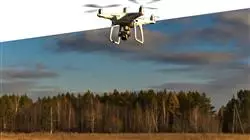
Drone photogrammetry is an important tool in the field of photogrammetry.
Learn online photogrammetry with drones
.
At TECH Global University, we have a highly qualified teaching team in the field of photogrammetry and remote sensing. They will guide you throughout your learning, providing you with the best practices and the most advanced techniques to carry out successful photogrammetry projects with drones. During the Postgraduate Certificate, you will acquire theoretical and practical knowledge about the principles of photogrammetry, drone handling, image processing, generation of digital terrain models, and interpretation of the results obtained. You will also learn about the legislation and regulations in force to operate drones safely and legally. At the end of the course, you will receive a recognized university certificate that will endorse your experience in photogrammetry with drones. You will be able to apply your skills in real projects and open your way in the labor field in engineering, consulting, mapping, precision agriculture and other sectors related to the capture and analysis of geospatial data. Don't miss this opportunity to specialize in a discipline in constant growth. Enroll in the Postgraduate Certificate in Photogrammetry with Drones at TECH Global University and take off towards a career full of possibilities!


