University certificate
The world's largest faculty of engineering”
Description
Access the latest techniques in 3D modeling applied to geomatics thanks to this postgraduate diploma”
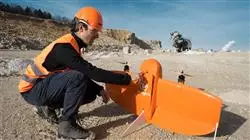
The technological revolution brought about by the appearance of new computer tools and the popularization of drones has made it possible for geomatics to have innovative procedures with which to carry out its different tasks. Therefore, traditionally the three-dimensional measurement was done more manually, but nowadays there are 3D modeling processes that make this task very accurate and fast, thanks to its combination with the discipline of photogrammetry.
This postgraduate diploma in 3D Modeling in Geomatics offers the professional an in-depth study of the latest developments in issues such as mapping with LIDAR technology, 3D scanning and georeferencing, the capture of support and control points, BIM technologies or the planning and configuration of photogrammetric flights with drones, among many others.
To make learning much more effective, this program is presented through an online teaching system that adapts to the circumstances of each student. They will also be supported by a high-level teaching staff made up of active professionals who will provide them with all the keys to this field. And the contents will be provided through numerous multimedia resources such as videos, interactive summaries or master classes.
Perfect your three-dimensional measurements by incorporating drone handling and 3D modeling into your work”
This postgraduate diploma in 3D Modeling in Geomatics contains the most complete and up-to-date program on the market. The most important features include:
- Practical cases presented by experts in Geomatics
- The graphic, schematic, and practical contents with which they are created, provide scientific and practical information on the disciplines that are essential for professional practice
- Practical exercises where self-assessment can be used to improve learning
- Special emphasis on innovative methodologies
- Theoretical lessons, questions to the expert, debate forums on controversial topics, and individual reflection assignments
- Content that is accessible from any fixed or portable device with an Internet connection
TECH's teaching methodology has been designed with working professionals in mind, as it adapts to them so that they can study without problems or interruptions”
The teaching staff of this program includes professionals from the industry, who contribute the experience of their work to this program, in addition to recognized specialists from reference societies and prestigious universities.
Thanks to multimedia content developed with the latest educational technology, you will be immersed in situated and contextual learning. In other words, a simulated environment that will provide immersive learning, programmed to prepare for real situations.
This program is designed around Problem-Based Learning, whereby the professional must try to solve the different professional practice situations that arise throughout the program. For this purpose, the student will be assisted by an innovative interactive video system created by renowned and experienced experts.
3D modeling is essential in current geomatics. Specialize in the field and develop exciting topographic projects with this program"
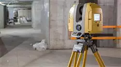
Geomatics is constantly evolving and this postgraduate diploma will provide you with everything you need to adapt to the latest developments in the discipline"
Objectives
The main objective of this postgraduate diploma in 3D Modeling in Geomatics is to offer the professional the latest contents in the three-dimensional measurement of nearby objects from the latest photogrammetric methods. To achieve this, the program offers you innovative knowledge in this area, as well as a high-level faculty with extensive experience in the discipline and a flexible teaching methodology, presented through numerous multimedia resources.
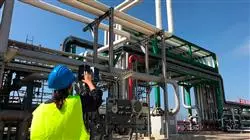
Incorporate the latest 3D modeling techniques in geomatics into your professional practice thanks to this specialized qualification”
General Objectives
- Generate specialized knowledge on LIDAR technology
- Analyze the impact of LIDAR data on the technology around us
- Compile LIDAR applications applied to Geomatics and future possibilities
- Examine the practical application of LIDAR by 3D laser scanning as applied to topography
- Design and develop near object photogrammetry projects
- Generate, measure, analyze and project three-dimensional objects
- Georeferencing and calibrating the project environment
- Define the parameters that need to be known for the elaboration of the various photogrammetric methods
- Prepare the three-dimensional object for 3D printing
- Integrate, manage and execute building information modeling projects
- Plan a photogrammetric survey according to requirements
- Develop a practical, useful and safe methodology for mapping with drones
- Analyze, filter and edit with topographic rigor, the results obtained
- Present in a clean, intuitive and practical way the cartography or reality represented
Specific Objectives
Module 1. Mapping with LIDAR Technology
- Analyze LIDAR technology and its multiple applications in today's technology
- Specify the importance of LIDAR technology in geomatics applications
- Classify the different LIDAR mapping systems and their applications
- Define the use of 3D laser scanning as part of LIDAR technologies
- Propose the use of the 3D laser scanner for topographic surveys
- Demonstrate the advantages of the massive Geoinformation acquisition system using 3D laser scanning, as opposed to traditional topographic surveys
- Detail a clear and practical methodology of 3D laser scanning from the planning to a reliable delivery of results
- Examine, by means of real case studies, the use of 3D laser scanners in various sectors: mining, construction, civil engineering, deformation control or earthworks
- Recapitulate the impact of LIDAR technologies on current and future surveying
Module 2. 3D Modelling and BIM Technology
- Determine how to proceed to capture with photographs the desired object to be modeled
- Obtain and analyze point clouds from these photographs using various specific photogrammetry software
- Process the different point clouds available, eliminating noise, georeferencing them, adjusting them and applying the mesh densification algorithms that best suit reality
- Edit, smooth, filter, merge and analyze 3D meshes resulting from the alignment and reconstruction of point clouds
- Specify the application parameters for curvature, spacing and environmental occlusion meshes
- Create an animation of the rendered mesh, textured and according to the set IPO curves
- Prepare and set up the model for 3D printing
- Identify the parts of a BIM project and present the 3D model as a base element for the BIM environment software
Module 3. Photogrammetry with Drones
- Develop the strengths and limitations of a drone for mapping purposes
- Identify the reality of the surface to be represented, on the ground
- Provide topographical accuracy by means of conventional topography, prior to the photogrammetric flight
- Identify the actual volume where we are going to work in order to minimize any risk
- Control at all times the trajectory of the drone based on the programmed parameters
- Ensure the correct copying of files to minimize the risk of file loss
- Configure the best restitution of the flight according to the desired results
- Download, filter and clean the results obtained from the flight with the required accuracy
- Present the cartography in the most common formats according to the client's needs
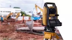
Drones and photogrammetry are the future for data collection to enable the representation of geographic information in 3D. Don't miss this opportunity and enroll now”
Postgraduate Diploma in 3D Modeling in Geomatics
.
Immerse yourself in the exciting world of 3D modeling in Geomatics with the Postgraduate Diploma program at TECH Global University. Through our online classes, we offer you the opportunity to develop advanced skills in the creation and visualization of 3D models for geospatial applications. At TECH Global University, we understand the importance of Geomatics in strategic decision making in various fields such as cartography, engineering and urban planning. Our Postgraduate Diploma program in 3D Modeling in Geomatics provides you with the necessary tools to master the most relevant techniques and software in the field of three-dimensional modeling, and apply them effectively in research and development projects.
TECH gives you the best tools for your learning
.
The program's online classes allow you to learn from anywhere and at any time, adapting your study to your own pace and schedule. You will be able to access interactive lessons, up-to-date learning materials and participate in online discussions with experts and classmates, which will foster your professional growth and the expansion of your network in the field of Geomatics. You will learn to use specialized 3D modeling and visualization software, applying advanced techniques to represent and analyze geospatial data. In addition, you will explore the practical applications of 3D modeling in surveying projects, urban planning, land management and more. Become an expert in 3D modeling in Geomatics and stand out in the professional arena with the Postgraduate Diploma program at TECH Global University. Enroll now and start bringing your ideas to life in the 3D world of Geomatics!
